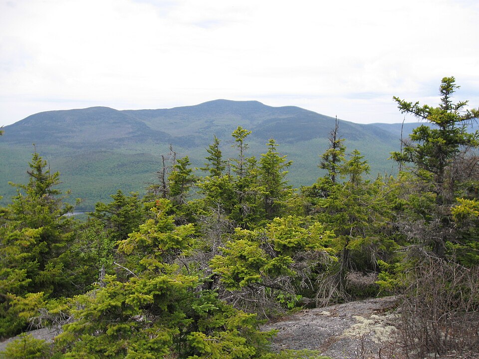
Summit elevation: published (Wikidata / USGS GNIS).
Does Sandwich Mountain have skiing?
No lift-served ski area on this mountain. Nearest ski area: Waterville Valley, about 4.7 miles (straight line).
Altitude at a glance
Mountain range
Sandwich Range · within the White Mountains (Wikidata)
County
Grafton County
Town / township
Waterville Valley
Summit
3,980 ft / 1,213 m
USFS trailhead used for comparison
Drakes Brook/Sandwich Mtn Trailhead: 1,417 ft (2.7 mi from summit, straight line)
Elevation difference
2,563 ft from Drakes Brook/Sandwich Mtn Trailhead to summit
Altitude note (estimate): using the standard lapse rate of about 3.5°F per 1,000 ft, expect the summit to be roughly 9°F colder than the trailhead, before wind chill. Above treeline, wind can make it feel far colder.
Effort score: 949 ft/mi — Moderate
Effort score = elevation gain ÷ straight-line distance from the nearest USFS trailhead to the summit (feet per mile). Trails wind, so real trail grades are gentler than this number. Under 500 Gentle · 500–999 Moderate · 1,000–1,499 Steep · 1,500+ Very steep. Use it to compare peaks, not as a trail grade.
Base map: USGS The National Map (public domain). Switch to OpenTopoMap with the layer button. Use for orientation only; carry a proper map and compass.
Summit weather
Loading the National Weather Service forecast for the summit…
Forecast: National Weather Service (api.weather.gov), for the 2.5 km forecast grid cell at the summit coordinates, which accounts for elevation. Mountain weather changes fast; check again before you go.
Who manages this mountain
White Mountain National Forest (USDA Forest Service), Saco Ranger District.
The summit is inside the Sandwich Range Wilderness, a federally designated wilderness with stricter rules (group size limits, no mechanized equipment).
Land unit from the USGS PAD-US database at the summit point; ranger district from USDA Forest Service boundaries. Office address and phone from the Forest Service offices page.
Trailheads: USDA Forest Service. Pass requirement: WMNF list of fee sites; at other trailheads we don't know of a fee. Check the official page before you go.
Sunrise & sunset today
Calculating…
Calculated in your browser for the summit coordinates (standard sunrise equation, Eastern Time). From a high summit with an open horizon, the sun appears a few minutes earlier and sets a few minutes later than the sea-level times shown here; the extra minutes are estimated from the summit's height.
Safety
Consider a hikeSafe card. It's sold by NH Fish and Game and helps cover the cost of a search and rescue if you need one, under NH rules. Carry the ten essentials, tell someone your plan and know when to turn back.
Huts, shelters & campgrounds nearby
Flat Mountain Pond Shelter(Shelter, USFS/AMC) — 2.2 mi
Waterville Valley Campground(Campground / campsite, US Forest Service) — 3.0 mi
Home values: Zillow Home Value Index (ZHVI), typical home, as of the month shown; when Zillow has no figure for a town, we show the Census ACS 5-year median home value (table B25077). Income: U.S. Census Bureau ACS 5-year 2020–2024 (via Census Reporter), table B19013. Population: same ACS 5-year release, table B01003.
Straight-line distance from the summit. Lakes and towns: NH Fish and Game fishing guide data. Boat launches: NH Fish and Game public access sites. Swimming: NH Fish and Game access sites and NH DES monitored public beaches. No badge means access is unknown, not that there is none. Check local rules before you go.
31.0 miles of USDA Forest Service–managed trail: the full length of every USFS trail segment that comes within 2 miles of the summit (computed from USFS trail GIS data).
Trail (USFS name)
Total length
Flat Mtn Pond Snomo
6.7 mi
Smarts Brook
4.9 mi
Algonquin
4.1 mi
Bennett Street Trail
3.7 mi
Sandwich Mtn
3.6 mi
Black Mtn Pond
3.3 mi
Fletcher Cascade
1.2 mi
Gleason Trail
0.4 mi
Lengths are each trail's full mapped length in USFS GIS data, not a summit route. Difficulty ratings are not published in this data, so we leave them out.
Summit sunrise & sunset by month
Mid-month
Sunrise
Sunset
Turn around by*
Jan
7:17 AM
4:31 PM
2:31 PM
Feb
6:46 AM
5:13 PM
3:13 PM
Mar
7:00 AM
6:50 PM
4:50 PM
Apr
6:04 AM
7:27 PM
5:27 PM
May
5:20 AM
8:03 PM
6:03 PM
Jun
5:02 AM
8:29 PM
6:29 PM
Jul
5:16 AM
8:27 PM
6:27 PM
Aug
5:49 AM
7:52 PM
5:52 PM
Sep
6:23 AM
6:58 PM
4:58 PM
Oct
6:58 AM
6:04 PM
4:04 PM
Nov
6:39 AM
4:21 PM
2:21 PM
Dec
7:13 AM
4:09 PM
2:09 PM
Computed for the summit coordinates with the NOAA solar formula, Eastern Time (DST applied). *Rule of thumb: be heading down at least 2 hours before sunset; start early enough to reach the summit before this time.
Best month to hike
Sep — the month with the fewest wet days (≥1 mm precipitation) among months where the average summit high reaches 50°F.
Month
Avg high
Avg low
Wet days
Jan
17°F
0°F
32%
Feb
19°F
1°F
36%
Mar
28°F
10°F
36%
Apr
40°F
22°F
43%
May
53°F
35°F
41%
Jun
61°F
44°F
49%
Jul
67°F
50°F
46%
Aug
65°F
48°F
40%
Sep
58°F
42°F
31%
Oct
46°F
31°F
40%
Nov
33°F
19°F
32%
Dec
22°F
8°F
39%
2006–2025 daily ERA5 reanalysis from the Open-Meteo archive, adjusted to summit elevation. Reanalysis smooths mountain weather; summits like Mount Washington are often colder and windier than shown.
 Mountains for hikers & skiers